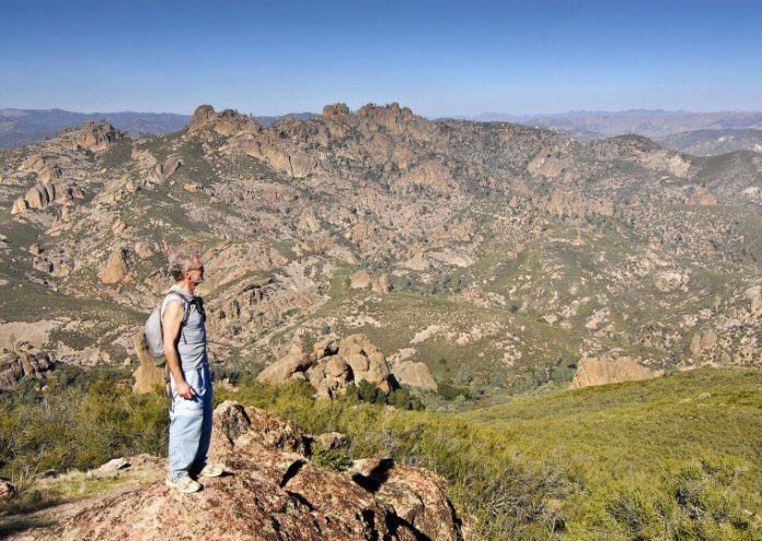
Pinnacles National Monument, nestled in the Gabilan Mountains an hour south of Hollister, boasts a fistful of marquis attractions. I recently joined a group of friends to hike to a feature that many people don’t even know is part of the park.
If you have visited Pinnacles, you know that the headline act is the outcropping of rock spires that give the park its name. The High Peaks Trail is a spectacular path along these crags often requiring railings and cut steps to make the precarious transit. Kids love the dark, twisting caves (bring a flashlight) along the Bear Gulch Cave Trail. Throw in a flashy spring wildflower display and the real possibility of seeing a California condor, and Pinnacles National Monument offers quite a show.
You can’t see Chalone Peak from the Bear Gulch day-use area, but it is conspicuous if you are driving on Highway 101 through the Salinas Valley near Soledad and King City. East of the highway, look for a massive pyramid with a slightly lower secondary peak. It rises majestically above all its neighbors and is topped with a fire lookout – a little nubbin on summit.
Strangely, Pinnacles National Monument has two entrances that are separated by the pinnacle ridge, and they don’t connect. The west entrance is up Highway 146, 12 miles east of Soledad. The main entrance is the east entrance, and about an hour south of Hollister on Highway 25 – a bit of a drive, but lovely the whole way.
Three cars full of gray-haired folks converged at Bear Gulch (east entrance), strapped on daypacks and set out. The route to Chalone Peak begins up Bear Gulch where the trail twists through a network of caves. These are talus caves formed by large boulders that have wedged into the narrow canyon.
The temperature must have dropped 15 degrees as we flipped on our flashlights and entered the dark twisting passageways. We carefully scrambled through narrow slots underneath low ceilings, watching each step carefully over the uneven ground. Here and there, we stepped across barely-trickling Bear Creek that followed the same canyon as the caves. Finally, a stairway cut into the rock lifted us up into sunlight and the small dam that holds back Bear Gulch Reservoir.
As if we had instantly left the snowy Sierra and arrived in San Diego, everything turned bright and warm. It was time to zip off the pant legs and stow the fleece.
From the dam, only the lower reaches of Chalone Peak were visible, but it was enough to define the task ahead. Up, up and up we went through chaparral country, tastefully appointed with an occasional gray pine or California juniper and, of course here and there, a leaping outcrop of red, rounded and rough rock characteristic of the Pinnacles.
Over an intervening rise, we got our first view of the summit and the fire lookout above. Still lots of work left to do, but now we were above the park’s famous pinnacles. The conversation and the widening views eased the effort.
If you go and reach the top, you will be tempted to cry out Leonardo DiCaprio’s king-of-the-world proclamation from “Titanic.” The entire world is beneath you. On this day, the air quality limited our view, but when I was there on a clear day, Monterey Bay, even the Moss Landing stacks, were crisp on the horizon.
It’s a perfect place for lunch.
The hike to Chalone Peak is a 9-mile round trip, and a 2,000-foot climb. But the gentle grade and the cool winter weather trim the work to a manageable effort and a fun day.


