Death Valley is the earth bare bones and naked. The light smattering of creosote bushes and cacti does not begin to disguise, even to a beginner’s eye, some of the simple features of the valley’s construction.
When the Sierra glaciers began to melt 10,000 years ago, Death Valley and its neighboring valleys began to fill with glacial melt, creating a network of huge lakes. At its largest, Lake Manly, the name given to the lake that filled Death Valley, was 80 miles long and 600 feet deep.
While Death Valley is the hottest and driest place in North America, the effects of water are everywhere. We are used to seeing alluvial fans at the mouth of a ravine or canyon where stream-carried sediment spreads out and collects in a fan shape over a wide valley floor. But in Death Valley, the alluvium is not in small, discreet fans. Slopes of alluvium run for miles and miles and rise thousands of feet. If you are not on the mountain slopes, you are on debris and sediment carried there by running water.
We entered the park on Highway 190 over 4,695-foot Towne Pass. Every inch of the 20-mile descent to Stovepipe Wells (elevation 10 feet) was down a steady slope of alluvium. This massive deposit extended as far as the eye could see. That’s not all. Beneath the valley floor, 8,000 feet of gravel, sand and mud have collected above the bedrock. The colossal influence of water in Death Valley is a striking contrast to the parched basin that remains.
We explored several washes and canyons full of alluvium during our visit, but the highlight was the hike up Corkscrew Peak. While not the highest peak in the Grapevine Mountain portion of the Amargosa Range, Corkscrew is a conspicuous and tantalizing target as seen from the valley floor. My like-minded, peak-bagging friends, who are veterans of many trips to Death Valley, knew this mountain had the right mix of effort and enjoyment.
We parked along Daylight Pass Road beneath a simple sign that read, “Corkscrew Peak, 5,804 feet.” Tighten the shoelaces, lather up with sunblock, shoulder the daypack and go.
We began our 3,000-foot, 3.5-mile climb up a broad, gently sloping wash of rock debris that was an artist’s palette of color. The sparse foliage made cross-country navigation a simple proposition, and high clouds kept the temperature ideal. Perfect for walking.
Guided by elaborate rock markers, we turned up, out of the wash and onto the lung-busting slope of the mountain. For a while, I just looked down at my shoe tops, because when I looked up, the peak was still too far away. But the near view did not disappoint. Though this landscape is dry and desolate, we enjoyed a succession of beautiful gardens and rock sculptures along the way. The foliage changed as we moved higher, as there were no more creosote bushes, but suddenly barrel cactus.
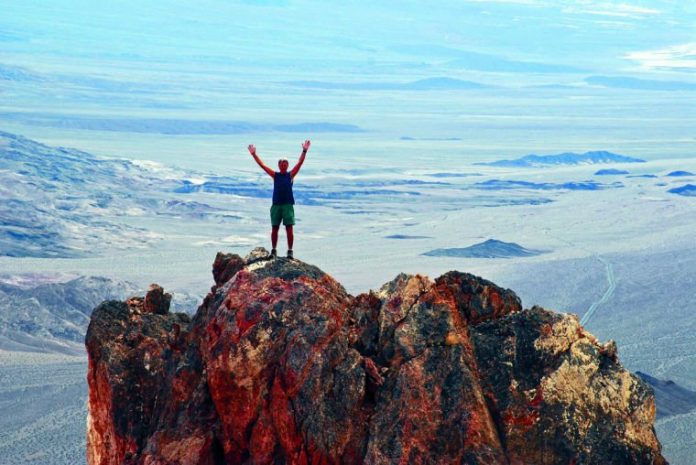
Finally, there was no more “up,” and the world fell away in every direction. The clear desert air and the bare landscape gave the scene an overwhelming immensity. We made entries in the summit register, took photos and snacked, but mostly just looked.
For many, the idea of slogging up a steep mountain peak is a tough sell. Somewhere in the hours of chest-pounding effort, the will is likely to give out. I believe that if the sales pitch could include a moment at the top, and the sense of pride the effort brings, everyone would go.


