When new backpackers ask me for a good place to go on that
important first trip, I struggle to think of a site with the right
mix of features. Now I have the perfect answer: Kibbie Lake.
When new backpackers ask me for a good place to go on that important first trip, I struggle to think of a site with the right mix of features. Now I have the perfect answer: Kibbie Lake.
The ideal first backpacking trip requires an unlikely combination of factors. The hike can’t be too long or too difficult, yet the destination must be high enough to touch the alpine country where the Sierra struts her granite stuff.
On the west side, it’s usually a long slog to the alpine country. The east side is a long drive, very rugged, and at elevations that will mean altitude sickness to most of us flatlanders. Finally, any place that qualifies on all these scores is likely to be crowded.
I read of a Yosemite ranger who touted Kibbie Lake as the best overnight backpack destination in the park – a strong recommendation that piqued my interest.
I have not been everywhere in the Sierra, but places I have not been, I have usually heard of. Kibbie Lake was new to me, and as I found out, very accessible. I wanted to see if the easy access led to a great setting.
Picture Yosemite National Park as an oval on the map. Kibbie Lake sits just inside the upper left portion of that oval next to Emigrant Wilderness which borders the park to the northwest. In fact, the trailhead to Kibbie Lake is also an entry point into the southern portion of Emigrant Wilderness.
Since this trail to Kibbie Lake straddles two jurisdictions, you can obtain a wilderness permit from either Yosemite National Park or Stanislaus National Forest. Since the road to the trailhead never reaches the park, I arranged to pick up my permit after business hours at the national forest office on our way through Groveland.
A few miles past Buck Meadows on Highway 120, we turned left onto Cherry Oil Road. Toward Cherry Lake, a twisty 20 miles away. From the lake, we drove across the dam and continued up, up, up (keep going) to the trailhead at the very end of the road.
We stashed some food items in the bear box at the trailhead, shouldered our packs and set out through terrain recovering from a 2003 fire. At a modest 6,500 feet, Kibbie Lake is only 500 feet above the trailhead, elevation we gained in the first mile when the morning was cool and we were fresh. Here, the trail forks; right to Kibbie Lake, left to Styx Pass and Emigrant Wilderness.
As we neared the lake, the trail joined robust Kibbie Creek. Along its banks, Western Azalea were bloomed in gaudy throngs. No carefully tended garden could surpass the extent and beauty of these natural azaleas that edged the creek over the last half mile to Kibbie Lake.
Getting closer, we passed still pools of clear mountain water trapped between protruding granite knobs, then a cascade, another pool, another cascade.
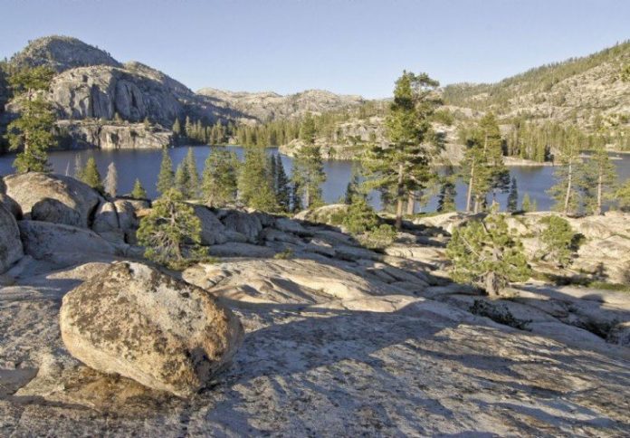
Nearing the lake, we walked across a granite landscape dotted with glacial erratics and an occasional ponderosa pine tucked in a sandy crease. The lake came into view atop a small rise – an easy slope to the edge on our side, plunging cliffs across the way.
We picked a campsite from among the flat sandy nooks above the lake. For complete privacy, bushwhack another quarter mile to your left where a hidden creek splashes its way toward the lake.
Kibbie Lake has all the stuff for a weekend getaway or that maiden backpack trip: classic Sierra scenery; a short 4-mile walk with a modest climb at a modest elevation; a manageable drive; relative solitude. It’s there waiting.


