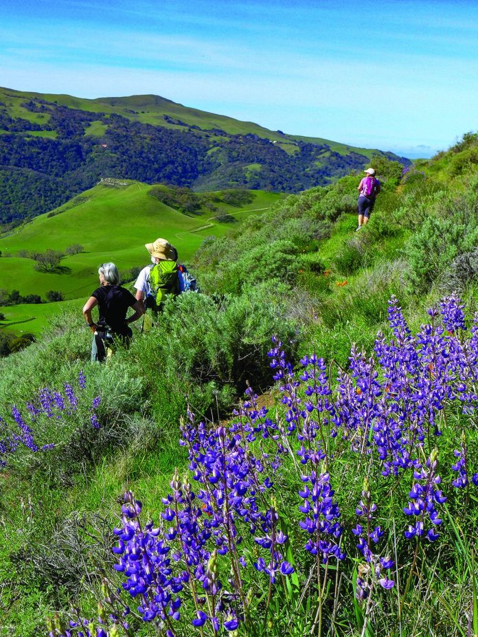
We have completed three of the six preparatory hikes in anticipation of the Round Top Challenge in the Sierra this summer. Our most recent hike at Sunol Regional Wilderness received rave reviews from all who came. Without a doubt, it was a stunner.
When I sent out the email of instructions and directions prior to this hike, I said that I remembered the loop for its healthy dose of huffing and puffing and for its spectacular views. For once, my memory didn’t fail me. We climbed 1200 feet—some of it up a grueling grade, but the views repaid the effort many times over. This loop is one of the best in the south Bay Area.
In Sunol Valley, Calaveras Road turns south off of Interstate 680. Four miles down Calaveras Road, a left turn onto Geary Road leads directly to Sunol Regional Wilderness. This 6,858-acre East Bay Regional Park boasts many miles of trails including a three-mile loop to a handsome waterfall in an area that is overbilled as Little Yosemite. But that would not be our goal this day.
Hiking shoes laced and day packs hoisted, we crossed Alameda Creek and walked a very short distance up the Canyon Trail, turned left onto the Indian Joe Creek Trail where our tussle with the theory of gravity began. We climbed steeply up a creek bed through a thicket of oaks and bay trees. A mile and a half out, as we turned onto the Cave Rocks Trail, the canopy opened and the view widened. To the west, a luscious green Mission Peak blocked our view of the bay. Below, the shrinking parking lot was an encouraging pat on the back.
A short distance up the well-named Eagle View Trail, the going eased and we began a delightfully level stroll across the slope. Here was our reward, and it came in an ever-changing setting. Across an oak-dotted grassy slope, we entered a dark tangle in a creek-cut hillside crease and emerged into a bright stretch of chaparral. Among the sagebrush, poppies and bush lupine were in full flower. The hillside was so steep along this portion of the trail that the parking lot seemed one step and a long free fall beneath us. Here was a glimpse into the world as seen by a soaring raptor.
Just beyond the chaparral, we stepped back onto oak grassland and the most prominent viewpoint on the loop. Southward, a gash in the Diablo Range was just wide enough to reveal Loma Prieta and Mount Umunhum. North of Mission Peak, the bay was now visible through the Sunol Grade. The rooftops of Pleasanton marked the beginning of the 680 corridor reaching north. Mount Tamalpais and Mount Diablo were both crisp on the horizon.
Energized by the views and a bite to eat, we began our descent through bright and open terrain. Down Vista Grande Road to Valley Road, we passed a huge barn set on a lovely broad bench. From there, we turned onto Hayfield Road and the last mile back to the trailhead.
I can think of very few trails that surpass this six-mile loop for every variety of spectator value. Have a large bowl of Wheaties before you go, but the variety of landscape and the tremendous views will drive the huffing and puffing from of your thoughts. Nearly any hike is a day well spent, but some you simply can’t miss. Don’t miss this one.
If you would like to join me on future hikes and maybe come with us to 10,381-foot Round Top Mountain this summer, contact me at ro********@*sn.com.


