Harvey Bear County Park, the high ridge east of U.S. 101 between Morgan Hill and Gilroy, is only the first in a succession of parallel topographic wrinkles that recede into the inner Coast Ranges. Beyond it, Coyote Reservoir, then Timber Ridge, Sheep Ridge and Palassou Ridge line up like an incoming set of seaside breakers.
When I drive out Gilroy Hot Springs Road, I often look longingly at these muscular ridges rising across Coyote Creek. I know the Santa Clara County Open Space Authority owns some portion of it, but which portion, and can I go there?
The SCCOSA owns a number of properties not yet open to the public, but that doesn’t mean you can’t visit them. Teri Rogoway, the Authority’s Educational Programs Coordinator simply won’t have it. Teri regularly offers docent-led hikes and other activities into otherwise closed properties. Awhile ago, I signed up at MeetUp.com to receive email notices of upcoming Authority events. When I saw that they had scheduled a hike for Palassou Ridge, I reserved a spot.
On Gilroy Hot Springs Road, a mile and a half past the Coyote Reservoir entrance, we parked by a dirt road blocked by a closed gate. Led by docents Katherine Dollard and Alice Lynch, we crossed a feeble Coyote Creek, then stepped up onto a broad alluvial creekside bench, a surprisingly bright spot in an area that otherwise feels like a narrow shrouded creek basin. Just ahead, we carefully inspected a beautiful stone house built by the Leavesley family as a caretaker’s cabin in 1941. Beside the house stood a massive 300 year-old valley oak. This impressive monarch had huge far-reaching branches that twisted and turned in the most artistic ways—another tree I would like to buy a beer for and hear it tell stories of all it has seen.
Beyond a short flat stretch of road with remnant structures of bygone ranching days, we started up, up, up. Yet again this spring, I was surprised to see an impressive flower display despite our very dry winter. Blue dicks, Ithuriel’s spear, poppies, blue-eyed grass and checkerbloom lit the slopes of Palassou Ridge, often in impressive displays.
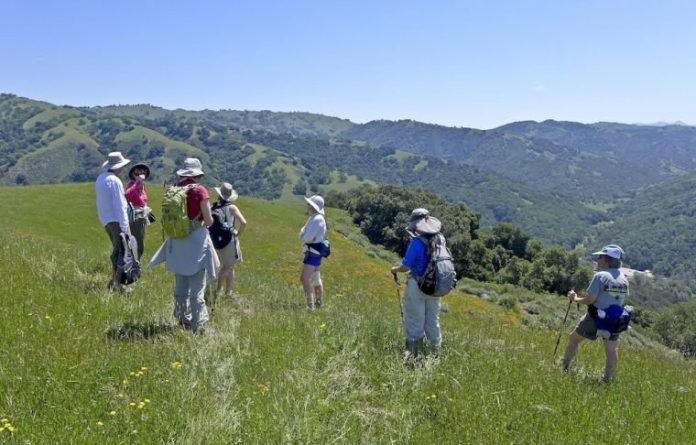
Each time we turned around, the creek below grew smaller and the landscape widened. When the ranch road reached a fence marking the property boundary, Katherine and Alice led us up a steep cross country route carpeted with poppies. The ground eventually leveled out atop a broad knob with great views in every direction. The property owned by the SCCOSA never reaches the ridge’s highest point, so our view to the north looked higher up the oak-studded grassy slopes. Beautiful, but not a distant view. South of us, down Cañada de los Osos, Cañada Road started on its way to Pacheco Pass. Turning east, we looked deep into Coe Park: Hunting Hollow, Steer Ridge and Wasno Ridge looked like green jewels on this bright crisp morning.
We criss-crossed the grassy hilltop, bright red checkerbloom everywhere. A few of us remarked that Julie Andrews should be here to break into song. Finally, we found a beautiful spot beneath a coast live oak and sat down for lunch in a fabulous setting. Just looking and looking.
Though Palassou Ridge—like Blair Ranch, Coyote Valley Open Space Preserve and others—is not yet open to the public, the SCCOSA wants you to see it. If you have a hiking group, call Teri at (408) 224-7476 to arrange a docent-led hike. Hikes and other activities are posted on the Authority’s website (openspaceauthority.org) and at MeetUp.com (search: Open Space Authority Hiking Enthusiasts).


