It’s three-something on Christmas Eve morning, my eyes have
opened and will not close again. I had planned to sneak in a hike
later this morning before Christmas preparations kicked into gear.
What the heck. Why not go now? Getting out before sunrise and
watching the day dawn will surely bring something special.
It’s three-something on Christmas Eve morning, my eyes have opened and will not close again. I had planned to sneak in a hike later this morning before Christmas preparations kicked into gear. What the heck. Why not go now? Getting out before sunrise and watching the day dawn will surely bring something special.
I drove to the Mission Boulevard exit off of Highway 680, headed east on Mission, then turned right on Stanford Avenue and followed it to the end of the road. It was 5:30 and 37 degrees when I pulled into the Mission Peak Regional Preserve parking lot. There was no hint of morning in the eastern sky, and the stars were bright despite the wash of lights from Fremont below. With the help of a flash light in my glove compartment, I found the foot of the trail and started on my way.
I felt an eerie but exhilarating sense of adventure as I set out into the darkness. The valley lights cast a faint glow over the peak, but all I could discern were shades of darkness — total blackness in the tree-clogged ravines and a lighter shade over the open grassy slopes. I could distinguish nothing beyond the trail’s edge, but Hidden Valley Trail is a dirt road that was easy to follow.
The elevation of Mission Peak is 2,517 feet and the walk to its summit rises over 2,000 feet in three miles. It is a steady and relentless climb. Later, when I returned to the car and looked back at the peak in the light of day, I was glad that I had climbed in darkness and was ignorant of the task ahead.
The effort of the climb stoked my internal fire and warded off the morning chill. As I climbed above the surrounding neighborhood, a vast sea of city lights began to appear. With every step the landscape descended beneath me and more of the Bay Area sparkled into view.
Two and a half miles out the grade eases for a moment at the junction with the Peak Trail coming up from Ohlone College. Here, I reached the ridge crest and my first view of the vast sweep of land beyond Mission Peak. I never thought I would be able to reach the summit before sunrise, but now it seemed possible. The steel gray in the eastern sky was hinting daybreak. I had 500 feet to go.
The final climb leaves the twisting and turning Happy Valley dirt road and follows the Peak Trail directly up the steep ridge toward the peak. On the exposed summit ridge, the weather took a bitter turn. A raging 40-mile-per-hour wind raked the crest, replacing the cool stillness I had enjoyed on the flank of Mission Peak.
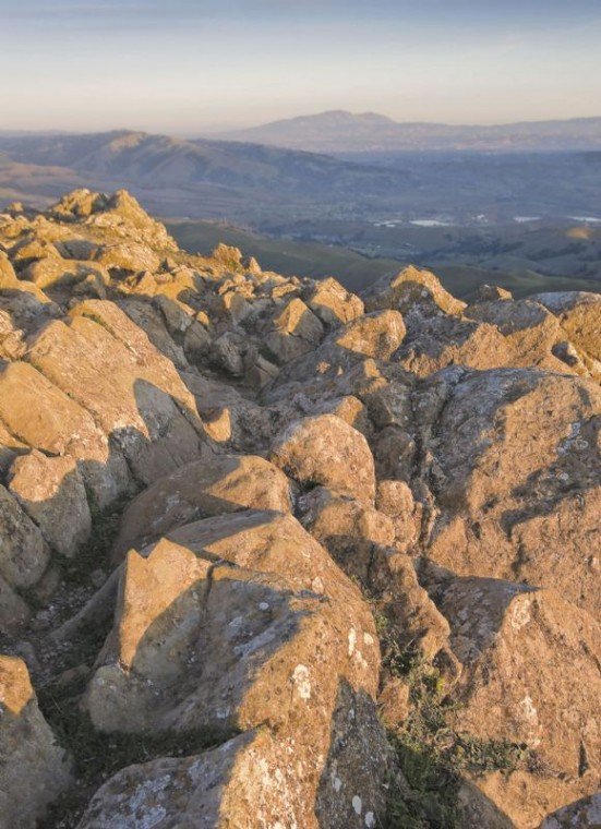
By 7 a.m. I was at the top, comfortably hunched in the lee of a protruding rock to escape the wind. The sun would not rise for another half hour, but the details of the Bay basin began to appear. Just in front of Mount Tamalpais was the crisp skyline of San Francisco. The Bay Bridge pointed to the still lit skyline of Oakland. Above San Francisco, the shadow line of the earth reflected on the morning mist slowly descended until the Christmas Eve’s first light finally kissed the Bay.
I was back in my warm Morgan Hill home by 9:30, but this special morning held all the adventure that I had previously only enjoyed on some remote Sierra crest; a challenging ascent, unparalleled views and bracing ridgetop weather. To recall the feeling of being truly alive, I recommend sunrise, or any time, on top of Mission Peak.
Final Reminder: I hope you will join me for a lovely New Year’s morning hike at Rancho Canada del Oro. We will meet at 9 a.m. at the preserve parking lot at the end of the paved portion of Casa Loma Road that turns west where Uvas Road becomes McKean Road, south of Cinnabar Hills Golf Course. There are options for every preference, including wheelchairs. Bring your own water and food. Dogs are not allowed.


