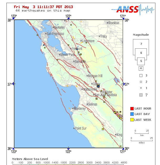
Residents of Gilroy were stirred, but not necessarily shaken by a 3.9. magnitude earthquake at 8:52 p.m. Thursday that caused a moderate rolling movement. The temblor’s epicenter was seven miles south-southwest of Hollister at a depth of six kilometers, according to the United States Geographical Service. The USGS describes the temblor as being “strongly felt in the Gilroy-Hollister area.”
The quake was initially reported by the USGS as a 4.1 magnitude temblor. That measurement was later adjusted to 3.9 by the USGS.
About nearby earthquake faults
The areas of Gilroy, Morgan Hill and Hollister are something of a terrestrial intersection where a handful of earthquake fault lines converge like superhighways (namely, Sargent, Calaveras, Quien Sabe, San Andreas and Paicines).
The southern segment of the Calaveras Fault produced two 6.2 magnitude earthquakes in Morgan Hill – the first in 1911 and the second in 1984. It also caused the 5.9 quake at Coyote Lake in 1979.
The 2003 Working Group for California Earthquake Probability assigned an 11 percent probability that the Calaveras Fault will produce a magnitude 6.7 or larger earthquake in the next 30 years.


