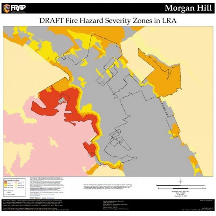
Morgan Hill and Gilroy lie between some of the most potentially
dangerous wildfire areas in the county, according to maps released
by Cal Fire showing fire hazard severity zones.
Morgan Hill and Gilroy lie between some of the most potentially dangerous wildfire areas in the county, according to maps released by Cal Fire showing fire hazard severity zones.
The state firefighting agency has prepared draft maps for local firefighting agencies that can study the areas listed as “very high fire hazard safety” and give input to Cal Fire.
The hillsides that cradle the city, including the Croy Road and Uvas Road areas, Henry W. Coe Park and areas east of it, are some of the most likely to have fires that are difficult to fight and spread quickly, according to the maps.
Fire Prevention Specialist Chris Morgan said the maps can help with fire prevention by making people more aware of potentially dangerous areas.
“Cal Fire created the maps to highlight high fire zones within our county,” he said. “They are important so that homeowners and fire agencies know about the danger, as they are a major tool for the agencies, for the public, to learn about the high hazard areas within Santa Clara County and the state.”
Maps for the state, counties and specific cities can be viewed on the Cal Fire Web site, www.fire.ca.gov.
The maps were developed as a tool to measure the physical fire behavior so that people can predict the damage a fire is likely to cause, according to information on the Web site.
Measuring fire hazard involves looking at components including the speed at which a wildfire moves, the amount of heat the fire produces and the burning fire brands that the fire sends ahead of the flaming front.


