I grew up just across the Golden Gate Bridge in Mill Valley. As I get grayer, the personal connections to my old home slip away, but the emotional link never dims.
The scenic beauty of southern Marin County is enough to stagger anyone even without the emotional boost that comes from having grown up there. On the Marin Headlands, miles of trails wander rolling hills edged with cliffs that dive into the Pacific Ocean. Look this direction through the towers of the Golden Gate Bridge, across San Francisco Bay to a world class skyline view. Turn a little to your left. Beyond Sausalito and a host of sailboats anchored in Richardson Bay is Belvedere, Tiburon and Angel Island, all looking like a scene from a Mediterranean postcard. Where in the world is there a more beautiful meeting of urban living and open space?
Last week I went to Mill Valley to visit a great old friend. In the decades I have known Charlie, the only walking I can remember him doing was to his next golf shot or across the room for a glass of wine. Lo and behold, Charlie is now a veritable John Muir and wanders all over the hills of southern Marin. Great! I’m on my way, and I want a tour.
Across the Golden Gate Bridge, Highway 101 climbs up and over the Waldo Grade before dropping back down to Richardson Bay. Simply put, the Marin Headlands is all the land west of this stretch of highway out to the open ocean. When I was growing up, it was all part of Fort Cronkite, a military base with a Nike missile site. Since then, it thankfully dodged development plans and became part of the Golden Gate National Recreation Area, a vast and varied collection of historic and natural sites from northern San Mateo County to Muir Woods on the flank of Mount Tamalpais.
The Marin Headlands are crisscrossed with a web of trails from which one can assemble any number of hiking or biking loops. Charlie suggested a car shuttle so that we could walk from point to point and not retrace our steps.
I dropped my car at the Tennessee Valley trailhead in Mill Valley, hopped in Charlie’s pickup, and we headed back toward San Francisco. Traveling back toward the bridge on Waldo Grade, we took the first exit at Rodeo Avenue, parked the car, and set out.
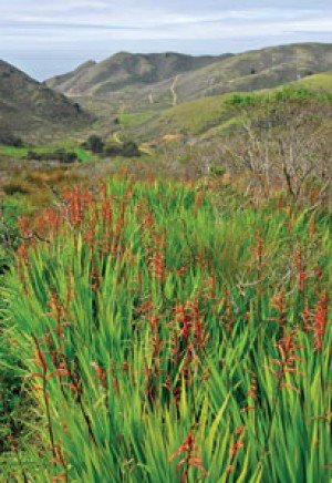
The first half mile is tucked in a crease and climbs gently toward the ridge tops. After the short ascent, the world dropped away in every direction. These grassy hills are coastal scrub dominated by coyote brush, toyon and other low-lying shrubs, none of which rise high enough to interrupt your view. The wind and fog can rake these hills, but we had a beautiful still day with chamber of commerce views: to the southeast, the San Francisco Bay out to Mount Diablo; Mount Tamalpais and Mill Valley to the north; and to the west, we looked across the repeating folds of the headlands to the ocean and the Farallon Islands 27 miles outside the gate.
Considering the dry winter we’ve had, I was surprised to see plenty of flowers. Checker bloom, ground iris, and star lily were the most common along the trail, but we also saw several harlequin flowers, a real stunner and a new flower to me.
Travel the world if you must, but you won’t find three prettier miles anywhere. Almost any route in the Marin Headlands will yield the same return. Just cross the Golden Gate Bridge, turn left and start walking.


