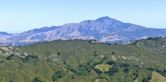
Over the many years I have lived in the Bay Area, I have overlooked the East Bay for hiking. I viewed the Amador, San Ramon and Livermore Valleys simply as corridors leading to the Sierra and other destinations beyond. But a recent visit to Las Trampas Regional Preserve chipped another bit of ignorance away and further opened my eyes to the East Bay's hidden gems.As you drive north on Interstate 680 through Danville and Alamo, Las Trampas Ridge follows you on a parallel path out your driver-side window. Just over the ridge is Bollinger Creek cutting a valley between Las Trampas Ridge and Rocky Ridge beyond. These two ridges and the adjoining valley comprise Las Trampas Regional Wilderness—at 5,342 acres, one of the largest East Bay Regional Parks.As I turned off Crow Canyon Road onto Bollinger Canyon Road, I was struck by how quickly the urban hubbub was forgotten in a bucolic setting that seemed many miles from the hustle and bustle I just left. Rather than a succession of modern day McMansions, Bollinger Canyon hid worn barns and ranch buildings that filled my mind with visions of an earlier California.The park staging area is in the bottom of the valley by Bollinger Creek-Las Trampas Ridge on one side, Rocky Ridge on the other. I talked with a friendly hiker in the staging area who knew the park well, and on her advice, I chose a moderate 4.5-mile loop that began on the Elderberry Trail at the foot of Rocky Ridge. The trail edged up through a forest of oaks, bays and buckeyes until I popped into open grassland and got my first hint of the views to come.Two miles out, I reached the Rocky Ridge View Trail 800 feet above the valley floor. Few hilltop roosts deliver a reward for a hiker's heart-pounding effort as grandly as the crest of Rocky Ridge. For the next two miles, I walked along the ridge crest that dropped steeply away from me on both sides. To the east, a crystal clear Mount Diablo rose above Las Trampas Ridge. To the west, across a huge expanse of protected watershed land, the view stretched from Mount Tamalpais down the length of the bay. But for lingering fog and haze, I would have seen the San Francisco skyline on one side and no doubt the Sierra on the other.The landscape of Central California changes steadily with each desiccating step inland. Only a few miles from the virtual rainforest habitat of the coastal redwood forests, oak woodlands predominate then give way to drought tolerant chaparral. I have rarely seen a habitat transition as stark as the one between this park's two ridges. Rocky Ridge was an inviting open grassland that still clung to spring's green, while across the way an impenetrable and forbidding thicket of chamise, buckbrush and other chaparral shrubs carpeted Las Trampas Ridge.Few Bay Area trails match Rocky Ridge View Trail for stunning spectator value. Mt. Diablo, Round Valley and now Las Trampas Regional Wilderness have upended my sour perception of the East Bay. I am discovering that there are not only parks with amazing trails and vistas, but country roads that twist through the hills and fool me into believing I am far, far away from a busy urban area. Ron Erskine is a local outdoors columnist and avid hiker. Visit him online at www.RonErskine.com, his blog at www.WeeklyTramp.com or email him at [email protected].


