After a stop at Peet’s for a foo-foo coffee, I decided the
quickest route to Rancho Canada del Oro was up and over Bailey
Avenue to McKean Road, then south to Casa Loma Road.
After a stop at Peet’s for a foo-foo coffee, I decided the quickest route to Rancho Canada del Oro was up and over Bailey Avenue to McKean Road, then south to Casa Loma Road.
Up toward San Jose, wispy cotton candy streaks drifting down from the featureless gray clouds seemed to assure that rain was on the way. As I crested the divide over Bailey Road, raindrops on my windshield confirmed my fears.
About a month ago, I put out a call in this column to anyone wanting to gather for a New Year’s morning hike at Rancho Canada del Oro.
This 3,882-acre preserve, with great hiking options and views for all appetites, is a lovely gem that most south county residents don’t know about.
What a great way to start the year. But with the weather threatening, I was afraid I was throwing a party, and no one would come.
I pulled into the parking lot at 8:30 a.m., a half hour before our meeting time, to be there ahead of arriving guests as any self respecting host would. Thankfully, the few drops of rain had passed, and, while the sky still offered little hope, all was dry for the moment.
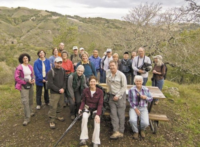
One car, then two, then a few more pulled into the preserve staging area. A bit later, I turned away from a brief conversation with a new friend to see a full parking lot.
Introductions were growing into new friendships as we began the climb to the ridgetop up Mayfair Ranch Trail.
Tree-sized manzanitas had sprinkled their light pink bell-shaped blossoms across the wide and comfortably graded trail. Underneath several dense groves of coast live oaks, white milkmaid blossoms brightened the gloom, and, early in winter, reminded us that spring is not far behind.
The Mayfair Trail really sings after about a mile, when it begins to ride the rolling ridge crest through grasslands dotted with wind-sculpted valley oaks, both elegant in appearance as well as Alfred Hitchcock eerie.
Here, the open landscape reveals great views. To the south, Llagas Creek and its tributaries; to the north, across Baldy Ryan Creek, rises Baldy Peaks.
Down the back side of the ridge and across the creek, we reached Longwall Canyon Trail and decision time; turn right and follow the creek for a pleasant 1-mile ramble back to the car, or turn left and battle gravity one more time up to a sweeping Bay Area overlook.
Most people decided to call it a day and follow the creek back home.
They had climbed 500 feet over the ridge, and, by the time they reached the parking lot, had hiked 4.3 miles.
The rest of us twisted and turned our way up through changing landscapes until we broke for lunch at a bench tantalizingly close to the top. The traverse of Baldy Peaks is high and wide open.
Mayfair Trail now seems far below, and the view to the south reaches to Morgan Hill’s El Toro Peak and beyond. But a short trot up one of the knobs of Baldy Peaks reveals a breathtaking Bay Area view.
The gray skies shrouded the view somewhat, but, with the help of binoculars, the San Franciso skyline peeked through beyond Calero Reservoir and the full sweep of the south bay.
It was a great day. Thanks to all who came. The beauty of the preserve was only surpassed by the quality of the company. The friendly chatter of “catching up” or “breaking the ice” filled every twist and turn along the trail. This group certified my long-held belief that you meet the nicest people walking the trails.


