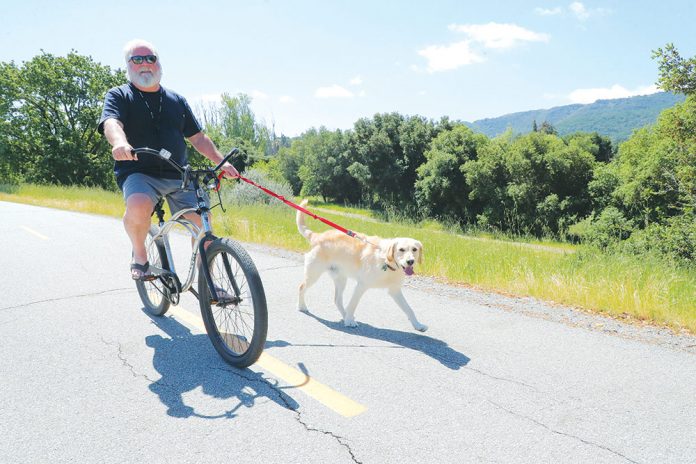
The weather has finally turned sunny and warm, and miles of new bike paths in Gilroy beckon cyclists of all ages.
Steady improvements and growth in the number of bike lanes and paths, with more to come this year, should make bicycling more safe, according to city officials.
Over 10 miles of bicycle infrastructure will be added in 2019.
The northern end of one trail—connecting the Gilroy Sports Park at the south end of the city with new housing developments along Hecker Pass—is scheduled to be completed this year.
The Hecker Pass bike/pedestrian trails will wrap around the new housing and come back down along Hecker Pass Road to Santa Teresa.
The Glen Loma bike/pedestrian trail will run along Santa Teresa from Thomas Road to the bridge at Third and Santa Teresa.
The Glen Loma and Hecker Pass paths will be entirely funded by local real estate developers.
The city also will be adding three bicycle “fix-it” stations along the way, for flat tire emergencies, bringing the city’s total to six stations.
Last weekend, the trail along Christmas Hill Park saw a variety of uses, including strollers, dog walkers, joggers, scooters and bicyclists.
Bicycle safety is a big concern of traffic planners in Gilroy, and when CalTrans repaves First Street later this year—after new water and sewer lines are in place— there will be new bike lanes along the street from Santa Teresa to Highway 101.
In December, Gilroy was named a Bronze Bicycle Friendly Community by the League of American Bicyclists, for its existing network of paths and trails and bike lanes and for its strategic plans, led by the local Bicycle Pedestrian Commission. Gilroy is among 464 bicycle-friendly communities across the US.
“We applaud these communities for making bicycling a safe and convenient option for
transportation and recreation,” said Bill Nesper, executive director for the League of American Bicyclists. “We are encouraged by the growing number of leaders who see bicycling as a way to build more vibrant, healthy, sustainable and connected communities.”
“Recently approved commercial and residential developments will have a direct impact in the city of Gilroy,” said bicycle commission chair Zachary Hilton, by achieving the commission’s goal to reduce motor vehicle emissions and improve air quality by encouraging residents and commuters to shift from vehicles to cycling and walking.
Here is a list of some of the city bicycle projects in the city’s strategic plan:
Hecker Pass Class I Bike/Ped Path
(Developer funded)
Location: Burchell Rd to Santa Teresa Blvd along Hwy 152
Description: Class I bike path connecting Hecker Pass
Development and along Hwy 152 on the south side
Llagas Creek Class I Bike/Ped Path Extension
(Measure B funded)
Location: Hwy 101/Sixth St following Llagas Creek to 1351
Pacheco Pass Hwy 152 , crossing over Hwy 152 to Luchessa Ave
Description: Class I bike path extending the Llagas Creek Trail
Lions Creek Class I Bike/Ped Path Extension
(Measure B funded)
Location: Kern/Tatum along Lions Creek to Santa Teresa and Day Rd
Description: Class I bike path extending the Lions Creek Trail
Lions Creek Class I Bike/Ped Path Extension
Location: Santa Teresa/Day Rd along Lions Creek to Day
Rd/Geri Ln
Description: Class I bike path extending the Lions
Creek Trail
Santa Teresa Class I Bike/Ped Path
Location: Santa Teresa/Castro Valley Rd along Santa Teresa Blvd to First St
Description: Class I bike path
Monterey Rd Class I Bike/Ped Path
Location: Monterey Rd/Buena Vista going north out of Gilroy along Monterey Rd
Description: Class I bike path
Uvas Creek/Gilroy Gardens Bike/Ped Bridge
(Grant and city funding)
Location: Hecker Pass Development Uvas Creek Class I Trail
Description: Bike/Ped Bridge to connect Uvas Creek Class I trail to Gilroy Gardens
10th St Bridge
Location: 10th St/Uvas Parkway
Description: Bridge for all modes of transportation/incorporating bicycle lanes
Ronan Class l Trail Project
(Federal, Santa Clara Water District and City funding)
Location: East Sixth St along the water district storm channel to Leavesley Rd, west branch of Llagas Creek
Description: Class 1 Trail with pedestrian/bike bridge at Sixth St
Las Animas Veterans Memorial Park
(Community Development funding)
Location: Las Animas Park
Description: Pathway Rehabilitation
Cohansey Bridge
Location: Cohansey/Nightingale Dr
Description: Bridge for all modes of transportation/incorporating bicycle lanes


