

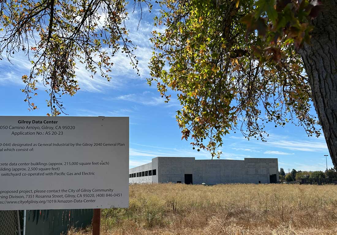
After a demand letter and a complaint were sent to local officials, the City of Gilroy conducted an investigation that determined that the land where an Amazon data center is under construction was not illegally subdivided, according to city officials.
City Administrator Matt Morley said after hearing about the complaint to the Santa Clara County Recorder’s office—alleging a violation dating back to 2020 of the California Subdivision Map Act related to the property at 8050 Camino Arroyo—city officials did their “due diligence” and consulted with a licensed land surveyor to “provide an independent, third-party assessment.”
The city’s examination included a review of parcel records. The complaint, filed by Gilroy resident Georgine Scott-Codiga, claims that in July 2020 the lot lines within the 66-acre property were redrawn illegally when the owner, Southpoint Business Park Associates, was preparing to sell or develop portions of the land.
The largest of the four lots—about 56 acres—was later sold to Amazon, who is building a new data center there.
Scott-Codiga also sent the city a demand letter urging city officials to declare the land was subdivided illegally.
Morley said in a letter to the public—distributed by the city’s e-newsletter and social media accounts—that the city’s investigation found that the 2020 lot line adjustments were done “in accordance with the California Subdivision Map Act, which prescribes how lot lines can be adjusted.”
Morley explained that while the new lot lines created distinctly differently shaped lots—and even moved one from the southern end of the property to the northern side—the adjustment was in compliance because it did not change the total number of four lots.
“You can move lots around as long as the math works, and you have the same number of lots” that the owner and surveyor started with, Morley said.
“This is why the adjustments did not trigger a review by the Planning Commission or City Council under the Map Act,” Morley’s letter added.
A response to Scott-Codiga’s demand letter from City Attorney Andy Faber included the same argument and stated the city will not declare the lot line redrawing was illegal.
“Although ‘new’ lots are described (in the parcel records), they are ‘new’ only in the sense of being newly-reconfigured,” reads Faber’s reply to Scott-Codiga. “In other words, one or more boundary lines between existing parcels have been removed or moved (which is the whole
point of a lot line adjustment); they are not ‘new’ in the sense that a greater number of parcels exists after the lot line adjustment than before.”
Scott-Codiga said in response, “They lied,” and maintains that the 2020 lot line adjustment was improper. She added that other aspects of the property’s transaction history—even going back before 2020—are suspicious.
“This goes to conspiracy, forged documents—this is major, big-time crimes,” Scott-Codiga said.
The county recorder’s office did not respond to a phone call requesting comments about Scott-Codiga’s complaint. Morley said this particular complaint process is somewhat obscure, and he doesn’t know if the county will conduct an investigation or draft a response.
In an interview at City Hall, Morley presented parcel records for the 2020 lot line adjustments, which included certificates of compliance signed by then-City Engineer Gary Heap, as well as Southpoint owners Eli Reinhard and John M. Filice. Morley added that each party hired a licensed land surveyor, who also signed and stamped the new lot lines as compliant.
For the recent investigation, the city consulted with surveyor Christopher Vandrey of BKF. Vandrey was “at least the third surveyor” to confirm the 2020 lots were created legally, Morley said.
The Map Act is described by all parties interviewed for this story as dense and complicated. The law dates back to 1893 and has been updated many times since then.
“The Subdivision Map Act has three principal goals: to encourage orderly community development, to prevent undue burdens on the public and to protect individual real estate buyers,” reads a 2003 lawsuit (unrelated to the Gilroy property) filed by two private property owners against Santa Clara County. “Thus, the Act serves ‘to coordinate planning with the community pattern laid out by local authorities and to assure proper improvements are made so the area does not become an undue burden on the taxpayer.’”
Scott-Codiga said she is preparing a more detailed response to the city’s conclusions, which she plans to share with the public through her nonprofit, Americans For Transparency. She added that she has also notified the local district attorney’s office and the California attorney general’s office of her allegations.
In a letter responding to Faber, Scott-Codiga wrote about additional issues, including an apparent renaming or reordering of parcel numbers by the assessor’s office following the 2020 lot line adjustment.
“A newly assigned APN (Assessor’s Parcel Number), in the Assessor’s own administrative practice, denotes a new parcel,” Scott-Codiga wrote. “If these were merely reconfigured existing parcels, the existing APNs would have been retained or modified—not replaced with new numbers.”
The 438,000-square-foot Gilroy data center project has been a source of significant community concern since construction started last year. The project was approved by the city’s community development director without a review by the planning commission or city council, as the city’s zoning ordinance currently allows.
Many members of the public, and some city councilmembers, have urged the city to revisit its zoning laws to require more thorough review for such projects.
“The public never had a review of this project. All they had was 45 days to reply to the (environmental study),” Scott-Codiga said. “They effectively kept the public out of this process by illegally subdividing the land.”










“We don’t want the Model-T!!!”
– horse carriage operators in the 1800s…
“We don’t want equal right for minorities!!!”
– “Christian” conservatives in the 1960s