Another phase in Gilroy’s urban trail system is on its way to
being completed, marking progress in a gradual but encompassing
goal of connecting the dots between one locale in the Garlic
Capital to many others
– and beyond.
Another phase in Gilroy’s urban trail system is on its way to being completed, marking progress in a gradual but encompassing goal of connecting the dots between one locale in the Garlic Capital to many others – and beyond.
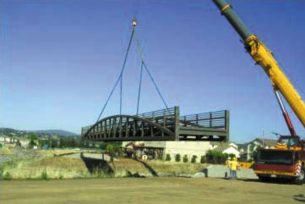
Headway on a quarter-mile trail linking Antonio Del Buono Elementary School to Lion’s Creek in north Gilroy hit a landmark mid-June, when workers finished a 110-foot long pedestrian bridge. The new structure, offering passage over Llagas Creek, is situated in residential recess and can be viewed near the intersections of Church and Woodworth, Church and Farrell and Wren and La Primavera streets.
In the future, City transportation engineer Don Dey said paths and trails appended to each other will allow pedestrians to walk or bike all over Gilroy, thus encouraging connectivity between “attractions that we have here in the city – whether it’s shopping or parks or schools.”
“We’re trying to build logical links,” he explained, “then, when we’ve got two trails that are fairly close together, we’ll close that graph and connect so that it’s a much larger trail network.”
The Lions Creek trail segment, which will run south along Church Street before heading west toward Wren Avenue, is the first northern link of the citywide trail system that will one day connect Gilroy to The Bay Area Ridge Trail. The ridge trail will ultimately be a 500-plus mile continuous passage for mountain bicyclists, walkers, hikers/trail runners, equestrians and outdoor enthusiasts, eventually encircling the entire San Francisco Bay Area from Yountville in Napa Valley in the north, all the way to Gilroy at its southernmost tip.
But one thing at a time for now, said Dey, who reminded, “a lot of this has to do with grant opportunities.”
In this case, the $1.15 million for the Lions Creek project came from grants provided by the California Natural Resources Agency and the Santa Clara Valley Water District, as well as city funds, according to David Stubchaer, City of Gilroy senior civil engineer.
Dey also emphasized a priority on taking care of Gilroy infrastructure first, continuing with a few more tracks to be designed over the next couple of years that are similar in fashion to what’s happening at Lions Creek.
He said the next logical trail projects for construction are the Uvas Creek Trail on the east side of Uvas Creek, the Ronan Channel from Sixth Street to Leavesley Road and Lions Creek from the current terminal point to CHS, but all of that will depend on the grant funding received, he said.
“It’s very locally oriented,” said Dey of the process. “Once we get those completed, then our next goal will be to see how we can connect to the Bay Area Ridge Trail.”
The Lions Creek Trail doesn’t connect to any other existing trails yet, Dey explained, but it is a part of a safe-routes footprint that will someday link Del Buono Elementary and neighborhoods in the east with Christopher High School and surrounding homes in the west.
Right now, Stubchaer said construction crews are pouring the concrete deck over pedestrian bridge at Llagas Creek, which could be open to the public by September. He pointed out improvements to the Lions Creek trail from Wren Street to Farrell Avenue and Kern to Wren avenues are a part of Gilroy’s Trails Master Plan, which was approved May 2, 2005.
Though it may take “generations to achieve,” the plan envisions trails circling the city, following creeks along the south and east that connect schools, parks, offices and traverse ridgelines toward Santa Cruz and up into the rest of the Bay Area.
Dey highlighted a collaboration between surrounding agencies including Caltrans and the Santa Clara County Water District, explaining as these neighboring groups embark on various development endeavors, “we put our requests to make city connections to their projects, so we can all connect.”


